The Crossroads That Stuck: Falmouth in the 1800s
Where Geography Made the Call
Falmouth didn’t become important because someone declared it so. It became important because of where it sat. By the early 1800s, the settlement that would become Falmouth occupied a rare geographic position at the confluence of the Licking River and its South Fork, a junction that functioned as both a natural crossing and a transportation artery into northern Kentucky. Rivers were infrastructure then, not scenery, and this one fed directly north to the Ohio River and the trade networks beyond.
(Kentucky Geological Survey, Licking River Basin maps)
Before Roads Had Numbers
Land routes followed the water. Long before paved roads or route numbers, wagon paths carved through Pendleton County along ridgelines and valleys that avoided steep grades. The north south corridor that would later become U.S. Route 27 was already established by the 1820s as a primary overland route connecting Cynthiana, Falmouth, and Covington. East west travel followed a similar pattern, creating a natural crossroads where traffic converged whether travelers intended it or not.
(Historical Atlas of Kentucky, Funkhouser and Price)
Why the County Seat Landed Here
This constant movement mattered. People stopped to trade. They rested horses. They exchanged news. And slowly, permanence followed traffic. Pendleton County was formed in 1798, but the question of where the county seat belonged was contested for decades. What ultimately tipped the scales was not politics but accessibility. By 1848, county records show the seat settled firmly in Falmouth, the most connected location in the county, and the easiest for residents from all directions to reach. With the courthouse came attorneys, clerks, surveyors, and the quiet machinery of governance that anchored the town.
(Pendleton County Court Order Books, Kentucky Department for Libraries and Archives)
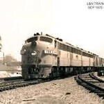
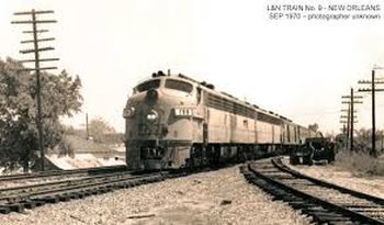
The Railroad Changes the Scale
Then came the rail line and with it, a different scale of movement.
In 1856, the Kentucky Central Railroad reached Falmouth, placing the town directly on the line between Lexington and Covington, two of the most economically active cities in the state at the time. Rail access didn’t replace the crossroads, it amplified it. Freight, passengers, mail, and ideas now moved through Falmouth faster and in greater volume than ever before.
Later the Kentucky Central Railroad was bought and absorbed by L and N Railroad.
(Lewis Collins, Historical Sketches of Kentucky, 1874)
Industry, Commerce, and Communication
By the post Civil War decades, state business directories paint a clear picture of what that connectivity produced. Listings from the 1870s show Falmouth supporting flour mills, distilleries, blacksmith shops, wagon makers, tailors, general stores, hotels, and multiple churches, all clustered around river access and rail proximity.
Weekly newspapers such as The Falmouth Pendletonian circulated local and regional news, further reinforcing the town’s role as an information hub.
(Kentucky State Gazetteer and Business Directory, 1876)
Falmouth’s Federal Role
Even federal systems acknowledged Falmouth’s position.
U.S. Post Office Department records from 1871 identify the town as a distribution and routing point for mail serving surrounding communities including Butler and rural Pendleton County precincts, reflecting its central role in regional logistics.
(U.S. Post Office Annual Report, 1871)
More Than a Dot on the Map
This is what Falmouth was in the 1800s:
Not an outpost.
Not a backwater.
But a node, where rivers met roads, where rail met river, and where people moving through northern Kentucky almost inevitably crossed paths.
In an era when connection was everything, Falmouth didn’t need to shout. It simply sat where the lines crossed and let history do the rest.
Whisper One Out
Trending Now